Saturday 30 April 2011

A Royal Magical Day

ap_kate__william_standing_church_nt_110429_wg

Britain's Prince William and his wife Kate, Duchess of Cambridge, stand outside Westminster Abbey after their royal wedding in London April, 29, 2011.

 Martin Meissner/Getty Images

Prince_460x230

Prince William and Kate Middleton now the Duke and Duchess of Cambridge seal their marriage with a kiss on the balcony of Buckingham Palace. 

www.nzherald.co.nz

Ilfracombe on the Royal Wedding Day.

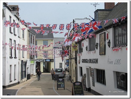
Wedding fever at Ilfracombe.Wedding fever at Ilfracombe.

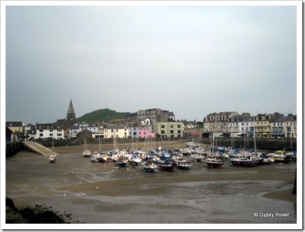
Ilfracombe harbour.Ilfracombe Harbour.

Despite it being a public holiday for Prince William’s wedding to Kate Middleton we opted to take one of only three buses available running a Sunday service into Ilfracombe. We decided that there would be reruns of the wedding played on TV later today. It wasn’t actually that far from the camp but just a bit too far to walk. The day started off overcast and windy but it did improve slightly during the day.

They must have been little people in the 14th Century.They must have been little people in the 14th Century.

Obviously a lot of people were at home glued to their TV’s for the wedding because the town was deserted until after lunch when the crowds started to arrive. We started at the quay side and slowly worked our way around the coastline.

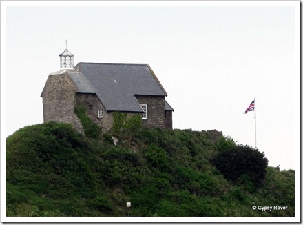
The Little Chapel on the hill. There has always been a lighthouse there since the Middle Ages. Henry VIII closed the Chapel in 1540.The Little Chapel on the hill. There has always been a lighthouse there since the Middle Ages. Henry VIII closed the Chapel in 1540.

We climbed the hill to the Little Chapel which dates back to 1321. Originally built for seafarer's to come and worship, it had always been a signal light for seamen to locate the harbour. In 1540 King Henry VIII closed it down as he did all over the country but the lighthouse was retained. Between 1835 and 1871 a John Davey was the lighthouse keeper where he raised his family of 14 children. The Chapel had  a chequered career as a reading room and a laundry where several of John’s daughters worked.

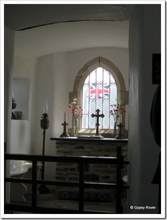
Inside the Little Chapel.Inside the Little Chapel. Reminds me of the ‘Church of the Good Shepherd’ in Lake Tekapo, New Zealand

After John left it was left to the elements despite it still being a lighthouse until 1962 when the Rotarians restored it and opened it to the public The building had no services when John lived there and everything had to be carried in. It was barely a two up two down sort of building and very small for all the Davey family. These days the lighthouse is fully automatic.

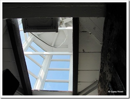
Looking into the lighthouse of the Little Chapel on the Hill. A Signal has operated from here since the middle ages.Looking into the lighthouse of the Little Chapel on the Hill. A Signal has operated from here since the middle ages.

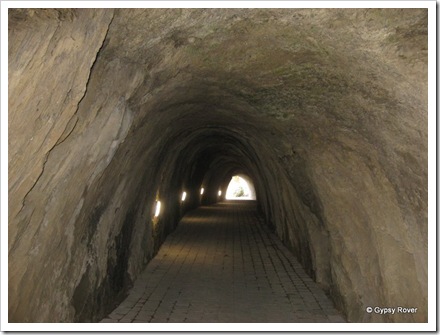
The beaches around Ilfracombe were mainly small and only one was what you could call sandy. The others were fairly coarse.  The old historic Victorian Tunnel Beaches and Bath House were set up as therapeutic remedies for what ever ailed you. Originally three beaches which were refreshed at every high tide, were accessed by 4 tunnels which were created by Welsh Miners.

Dug by Welsh miners in 1823 to Crewkhorne CoveNot a canal tunnel this time. Dug by Welsh miners in 1823 to Crewkhorne Cove

The tunnels were very similar to canal tunnels where you can see the chisel mark’s in the rock where they drilled holes and blasted  the rock away. Two beaches were segregated for male and female only and the ladies had the use of bathing huts where they changed in the huts and were then wheeled down to the waters edge out of the view of others. Water was heated and pumped up to the Bath House where the local’s took advantage of being able to have hot baths.

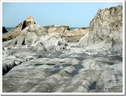
Smooth worn rocks in Crewkhorne Cove.Smooth worn rocks in Crewkhorne Cove.

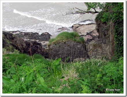
You need to be careful around these clifftops.You need to be careful around these clifftops.

The Landmark theatre reminded us of the Beehive Parliamentary building in Wellington but in duplicate. Who ever designed it couldn’t have had much imagination. We had a good wander through town picking up some souvenir’s and flavoured fudge before heading back to the rather derelict bus station for the bus back to camp.

Not a nuclear power station but a theatre at Ilfracombe.Not a nuclear power station but a theatre at Ilfracombe.

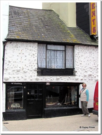
The oldest street in Ilfracombe.The oldest street in Ilfracombe.

Friday 29 April 2011

Farewell Cornwall.

59.6 Miles. Now at the Twitchen Farm CL near Ilfracombe.

We have thoroughly enjoyed our time in Cornwall but it was time once again to move on. Just an hour and a half to our next campsite just outside Ilfracombe. Tomorrow being a public holiday due to the wedding of Prince William and Kate Middleton we are hoping that the buses will be running probably to a Sunday timetable and we can visit Ilfracombe.

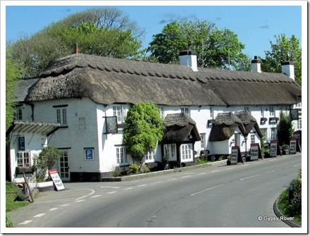
Now that's a lot of thatching. The Hoops Inn on the A361 near Bideford.Now that's a lot of thatching. The Hoops Inn on the A361 near Bideford.

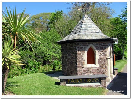
Ornate bus shelter on the A361 at Fairy Cross near Bideford.Ornate bus shelter on the A361 at Fairy Cross near Bideford.

Todays trip didn’t have much of any interest except the satellite receiving station on the coast near Bude. About a dozen huge satellite dishes sitting up on the horizon which you cannot help but see for miles around.

Satellite receiving station near Bude in Devon.Satellite receiving station near Bude in Devon.

Arriving at the camp we found we were the only campers and the owner had just finished cutting the grass. He was using a ride on mower which was fitted with a miniature silage chute and high sided trailer to catch the grass and take it away. Nifty little contraption.So we won’t be traipsing grass cuttings into the Motorhome over the next 2 days.

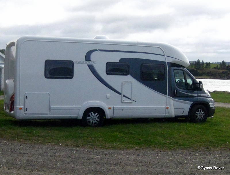
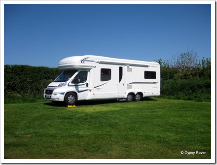
Gypsy Rover at Twitchen Farm.Gypsy Rover at Twitchen Farm.

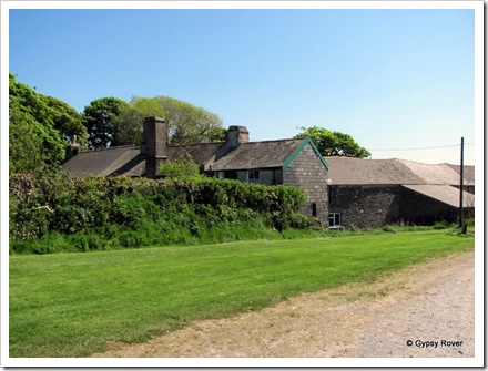
Twitchen farm CL. The front of the owners house. The house on the right (3 windows) was built 1680 so how old is the original house?Twitchen farm CL. The front of the owners house. The house on the right (3 windows) was built 1680 so how old is the original house?

Twitchen farm CL. The back of the owners house and old barns.Twitchen farm CL. The back of the owners house and old barns.

A total of 1571 miles, since 5 March 2011

Thursday 28 April 2011

Tintagel

Once again the scenery around this part of the country is stunning especially when we reached Tintagel where the fable of King Arthur was born and Merlin’s Cave is located.

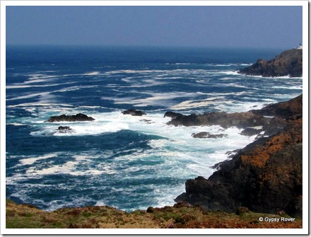
Rugged Cornish coastline.Rugged Cornish coastline.

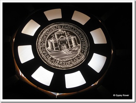
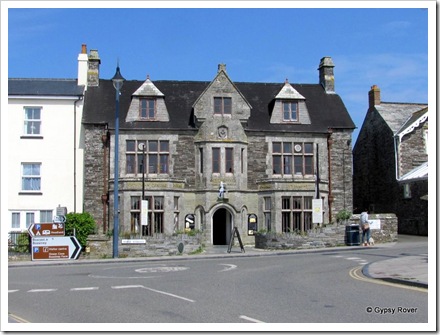
Unusual  glass ceiling at the tourist info centre at Tintagel.

Unusual  glass ceiling at the tourist info centre at Tintagel.

Tintagel and King Arthur's Great Hall's. Read all about King Arthur here.Tintagel and King Arthur's Great Hall's. Read all about King Arthur here.

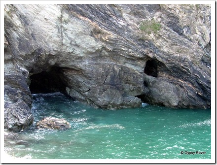
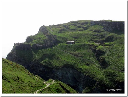
Alongside the cave is the drainage tunnel from a dis-used silver-lead mine called Wheal Heart under Tintagel Castle. Wheal is Cornish for mine. This mine was closed and re-opened between 1806 and 1873 three times and finished up with the name King Arthur’s mine.The cove was also used by ships to discharge coal and load finest Cornish slate. They would be beached on the out going tide and re-floated at the next high tide.We walked the coastal track from the Camelot Hotel around to the castle where we could see all that there was to see without having to pay to go across the bridge to what is relatively an island. With my Canon zoom camera I was able to photograph most of the castle from the track.

Cornish slate walls built with just earth.Cornish slate walls built with just earth.

Merlin's cave at Tintagel castle. The cave to the right is an exit from a dis-used silver mine.Merlin's Cave at Tintagel Castle. The cave to the right is an exit from a dis-used silver-lead mine.

Tintagel castle.Tintagel Castle.

Tintagel castle built on a cliff top.Tintagel Castle built on a cliff top.

Tintagel castleTintagel Castle in the background

As we walked back up the hill to the village we walked past a stream where one of the English Heritage staff members was building a dam across the stream. It transpired there was a Brook Trout in under a rock and it didn’t have very much water in which to swim so he was creating a deep pool just for the fish. Ahh! ain’t that sweet.

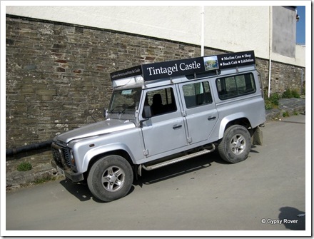
Tintagel castle taxi service if you don't have the energy to walk up the hill.Tintagel Castle taxi service if you don't have the energy to walk up the hill.

Port Isaac aka Port Wenn.

Well you don’t have to go to the fun fare to ride the big dipper, you just hop on a Western Greyhound bus between Camelford, Port Isaac, Port Gaverne, Tintagel and Wadebridge. The road was up hill, down dale, narrow, twisty and in places barely 8 feet wide. The bus drivers just take it in their stride, driving as if they were on a main road. It got very interesting when we met another large vehicle with just millimetres to pass each other. Nail biting, edge of the seat stuff.

Unusual town clock at Port Isaac.The town clock alongside the harbour in Port Isaac.

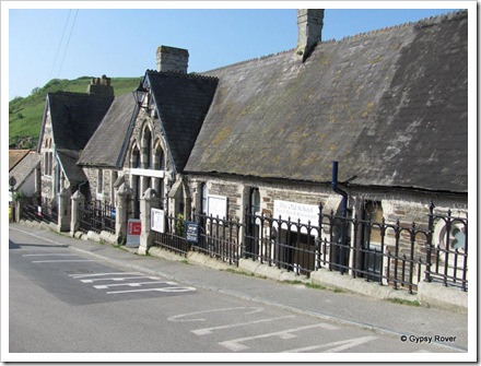
The Old Schoolhouse Port IsaacThe Old Schoolhouse Port Isaac

Arriving in Port Isaac we were informed that some area’s may be closed off as they were filming another series of ‘Doc Martin’. We did see Martin Clunes aka Doc Martin from afar outside his house but got very close to his girlfriend Louisa ( Lisa Glasson) before she was whisked away in a chauffeur driven car. Funnily enough Martin appeared on the local TV news just after we arrived back at the van.

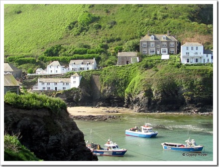
Port Isaac aka Port Wenn. Doc Martins house is the third from the right.Port Isaac aka Port Wenn. Doc Martins house is the third from the right.

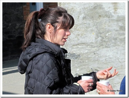
Lisa Glasson aka Louisa from Doc Martin.Lisa Glasson aka Louisa from ‘Doc Martin’.

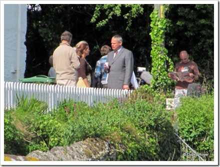
Martin Clunes aka Doc Martin talking to the production team.Martin Clunes aka Doc Martin talking to the production team.

Port Isaac harbour just for fishing boats.Port Isaac harbour just for fishing boats.

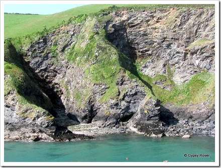
Craggy Cornish cliff's.Craggy Cornish cliff's.

Wednesday 27 April 2011

Happy Birthday Reece

632090va9mx8zeyt

Hope you have a lovely day

Happy Birthday Mary

1010715widgenud61

Please accept a raincheck for belated hugs and kisses in August.  See you soon.

Heading to North Cornwall.

65.8 Miles. Now at the Valley Truckle Club site at Camelford.

It was a fairly relaxed start to the day with the usual servicing of the tanks. Once underway we headed for Tesco’s at Penzance who were very conveniently along our route. Again we struck lucky with plenty of parking space. Shopping done and stowed away we were on the move once more.

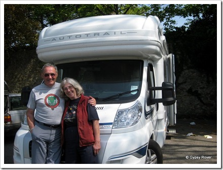
Cornwall.Janet took this photo today one of the few we have with the two of us.

We hadn’t been going long when my phone rang and it turned out to be a distant relative who had contacted me through the website/blog. We knew she lived in this neck of the woods but when we rang her last Thursday there was no reply so assumed she had gone away for Easter. How wrong we were, she had been working out on her farmlet somewhere but didn’t check her answer phone until today. Anyway she was on her way to Camborne to collect some animal feed. She gave us instructions where we could meet up as we would be passing by Camborne. The instructions didn’t quite work but we finished up in a coach park where we finally met up for a good long chat and a cuppa about 20 minutes later.

Derek and distant relative Janet Davies at Camborne in Cornwall.Derek and distant relative Janet Davies at Camborne in Cornwall.

Back on the road and it didn’t take long to reach our next camp site where there are only 6 other vans in residence. Once set up we walked into the village to check on buses and timetables for tomorrow. The local information centre is in the local museum where we had a good long chat with the museum curator.

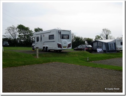
Gypsy Rover at Valley Truckle camp, North Cornwall.We’ve done it again, hanging over the back of the camp site.  Oh well.Smile

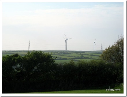
As we are about 6 miles from the coast our view tonight is 4 very large wind turbines on the horizon with 3 working and one feathered and idle.

IMG_1811

A total of 1511 miles, since 5 March 2011

Tuesday 26 April 2011

Picture Postcard Cornwall.

IMG_1740

Decisions, decisions. Where to go, what to see. With it being Easter Monday public transport was on Sunday service so this restricted our movements some what. We eventually caught a #300 open top tour bus to Lands End where we took some photo’s from the top deck. We only had 10 minutes and we were on our way again through Sennen where the bus went down hill into the village OK but struggled coming back up.
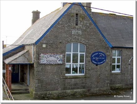
Sennen school, the first school in the land.Sennen school, the first school in the land.

It was then on to St Just and Botallack where the road was so narrow through the main street passengers on both side of the bus could touch the buildings simultaneously,scary. Onto our final destination which was Geever Tin Mine. We had 4 hours before the next bus and thought we would be bored stiff but that was far from the truth.
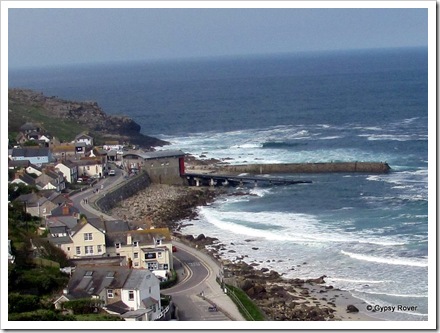
Sennen village below us on the open top bus.Sennen village below us on the open top bus.

A walk through part of the old mine with barely five foot headroom in places and only wide enough for one person to get through at a time. We were shown how the mine boys of about 11 or 12 years of age would hand drill a work face of 6 feet wide in steps of four feet high to the height of 48 feet. One boy on each step would drill 3 holes 4 feet deep in a 7 hour shift using just a lump hammer and 3 different length iron spikes with a tempered chisel end.
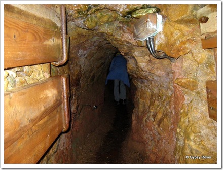
A tight fit through here.A tight fit through here.

Once this was finished a miner would come along and charge each hole with gun powder, insert a fuse consisting of about 10 goose feather quills trimmed on the sides and ends and inserted end on end. These were then filled with gunpowder and inserted in each hole and then plugged with clay. The miner using the candle on his helmet then started lighting the fuses at the bottom and then scrambling up the steps lighting more fuses as he went. If he was nimble enough he would be at least 4 steps up before the bottom step exploded followed all the way to the top.
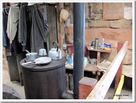
Miners are never far from their work even at meal times.Miners are never far from their work even at meal times.
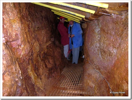
A tin rich seam in Geever mine.A tin rich seam in Geever mine.

All the rock was then shovelled down shafts to another working below where it was loaded into boxes with handles to be carried away by 2 boys to where it could be hauled up to the surface for the next process. This was carried out by women who were known as Balmaids (often only 12 or 13 years old). Their job was to pound the rock into powder using a tool similar to a 5lb sledge hammer with a broader head. They had to swing this hammer for 7 hours a day and were paid by their output. They were the only women to earn their own income in the 19th century. At home these women were the boss because their menfolk dare not argue with them as they might come off second best. Needless to say deafness was a way of life among Cornish mining families.
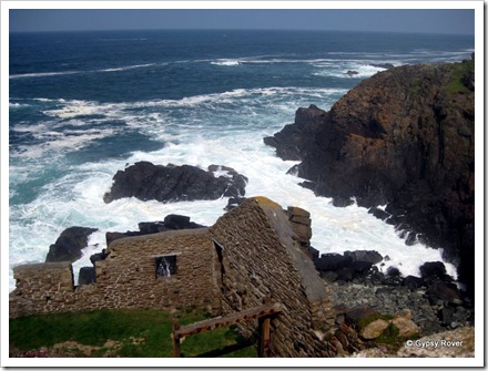
IMG_1775Buildings were built precariously close to cliff faces.

The mines around Cornwall yielded about 7% tin from the rock mined so there was a very high wastage which was just dumped over the cliffs. Some mines extended miles out under the sea bed where water entering the mines was a problem until the invention of Beam engines which could keep the mines water free by pumping it out. The end of tin mining came to an end in 1990 when the price of tin dropped from £10,500 per ton to £3,500 making it unprofitable. Tin is now mined overseas where it’s possible to use open cast mining and is cheaper to produce. There were also by products of Copper and Arsenic but Tin was the mainstay for the miners.
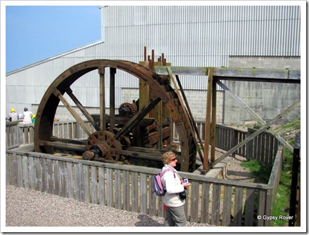
The first mechanised stamping machine operated by water.The first mechanised stamping machine operated by water.

Between 1880 and 1890 130,000 Cornish miners and 40,000 family members emigrated to America, Africa, Australia and New Zealand in search of a better way of life. They mined for precious metals and stones and those lucky enough to strike it rich returned to their birthplace to retire or take on a less strenuous form of work.
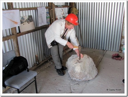
Dot trying her hand at hand drilling at the Geever tin mine.Dot trying her hand at hand drilling at the Geever tin mine.

It transpired that 4 hours wasn’t long enough and we had to miss out on some of the displays or we would have missed the bus back to camp. We did contemplate going to Lands End and taking the cliff walk back through Sennen, onto Sennen Cove and then up the hill to camp but we thought this might be taking on too much so left the bus at the camp gate.
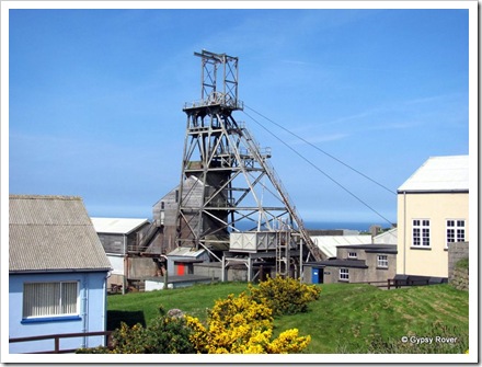
Geever tin mine, Cornwall.Geever Tin Mine, Cornwall.

Wild Cornish coastline.Wild Cornish coastline.

Monday 25 April 2011

Atlantic Ocean ahead.

82.3 Miles. Now at Lands End.

Gypsy Rover at Penzance sea front car park.Gypsy Rover at Penzance sea front car park.

We were in no hurry today as our next stop over, Trevedra Farm camp, request no arrivals before 1500 hrs. After filling and emptying all the relevant tanks we set off around 10.30hrs. Considering it was Easter Sunday with more fine weather the traffic wasn’t too bad.  During the course of the trip we pulled off the road twice for a cuppa and some lunch just to fill in time.

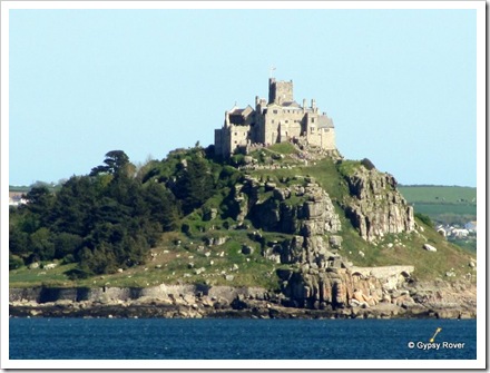
St Michael's Mount across the bay from Penzance.St Michael's Mount across the bay from Penzance.
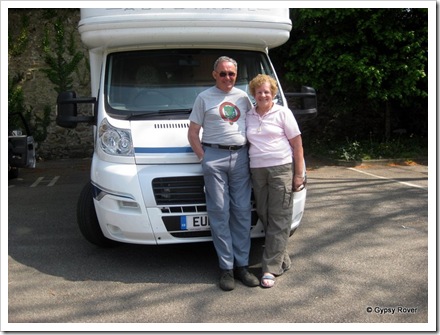
Reaching Penzance we were still early so we pulled into the sea front car park which luckily was fairly deserted allowing plenty of room for us. We noted that there were plenty of other motor homes in the car park as well. We had a long chat with the owners of the camper with the Kiwi sticker on the back who are in the process of moving to New Zealand to join their son. An hour was spent walking around the harbour docks and back. Two large fishing boats were in the dry dock getting their hulls painted as well as some other work. There seems to be quite a large ship repair industry in the town which was a bit of a surprise.

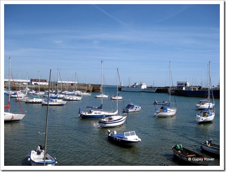
Penzance harbour with the Isle of Scilly ferry at the harbour entrance.Penzance harbour with the Isle of Scilly ferry at the harbour entrance.

Again we found the new site quite easily and it turned out that we were the first arrivals for the day even though it was 16.30hrs. It didn’t take long to sort out how far we are from Land’s End and what the bus situation is although tomorrow being a holiday this information may not be correct. Time will tell.

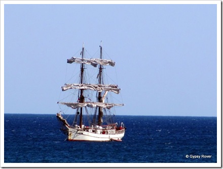
This beautiful sailing ship moored off the coast at Penzance.This beautiful sailing ship was moored off the coast at Penzance.

The camp is divided into 5 sections, each catering to different styles of camping. One section is full of VW Combi type campers with tents who are predominantly surfers. Since our arrival we have seen quite a few surfers coming back from the beach which is only 10 minutes walk away. They have a designated area in which to wash down their boards and wet suits and the shower room has been very busy also.

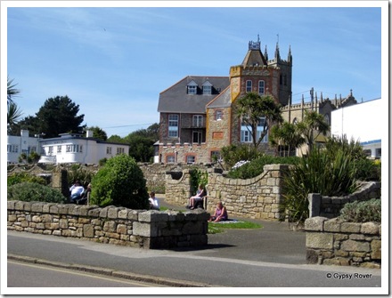
Sailor's Institute Mission hall, Penzance.Sailor's Institute Mission Hall, Penzance.

A total of 1445 miles, since 5 March 2011